







Zostel
The Banikhet cover: A clear, windy autumn morning above Banikhet
Dainkund Peak on Valley Blue — the Banikhet tile
Language

Banikhet

Dainkund Peak · Himachal Pradesh · India

Make its poster The kit
The Banikhet cover: A clear, windy autumn morning above Banikhet
Dainkund Peak on Valley Blue — the Banikhet tile

Why this icon Dainkund, the 'singing hill' above Banikhet: the wind in its deodars makes music. Source: incredibleindia.gov.in

Zostel

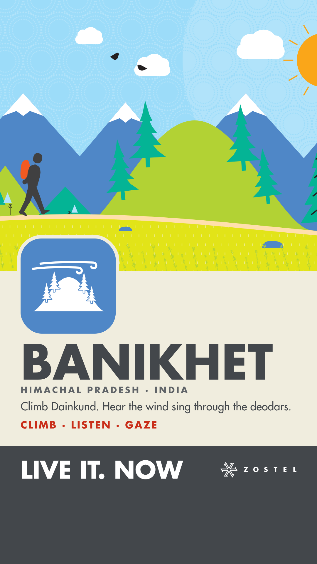
Climb Dainkund. Hear the wind sing through the deodars.

CLIMB · LISTEN · GAZE

The story

A clear, windy autumn morning above Banikhet: a traveller walks the open crest of the ridge into the wind toward the summit of Dainkund, the 'singing hill', its deodars bending, clouds streaming over, a griffon hanging on the updraft and black kites wheeling over the valley, the forested foothills falling away below to the snowy Dhauladhar across it.

Why this picture

Dainkund rises above Banikhet and Dalhousie out of the deodar, blue pine and oak forest of the Kalatop-Khajjiar country to an open grassy top of rocks and tawny grass, where a beaten path runs along the crest to the summit; the wind in its deodars gives it its name, the singing hill, and Himalayan griffons and black kites ride the updrafts along the ridge. In the clear air after the monsoon the snowy Dhauladhar stands across the valley.

The sky wears Khovar, from Hazaribagh, Jharkhand.

The motion

Clouds stream across the whole sky on the wind; the sun's rays turn; the deodars bend in the wind and gust further over; the crest's grass leans and bends; the griffon hangs on the updraft, rising, falling and tipping its wings; two black kites wheel over the valley; the traveller walks. A 16-second loop.

Colour

Orchid #AA5EA5
Valley Blue #4F87C7
Blush #F6ADCD

Banikhet takes Valley Blue #4F87C7, one of the three Valleys colours — with its icon in white on it.


Another moment in Banikhet

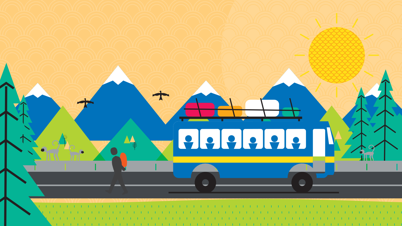
A second scene: another true moment at Banikhet, drawn in the graphic vocabulary with the animals and city symbols that belong there. Wide for screens, tall for a phone held upright.

The second Banikhet scene: A golden winter afternoon at Banikhet

The story

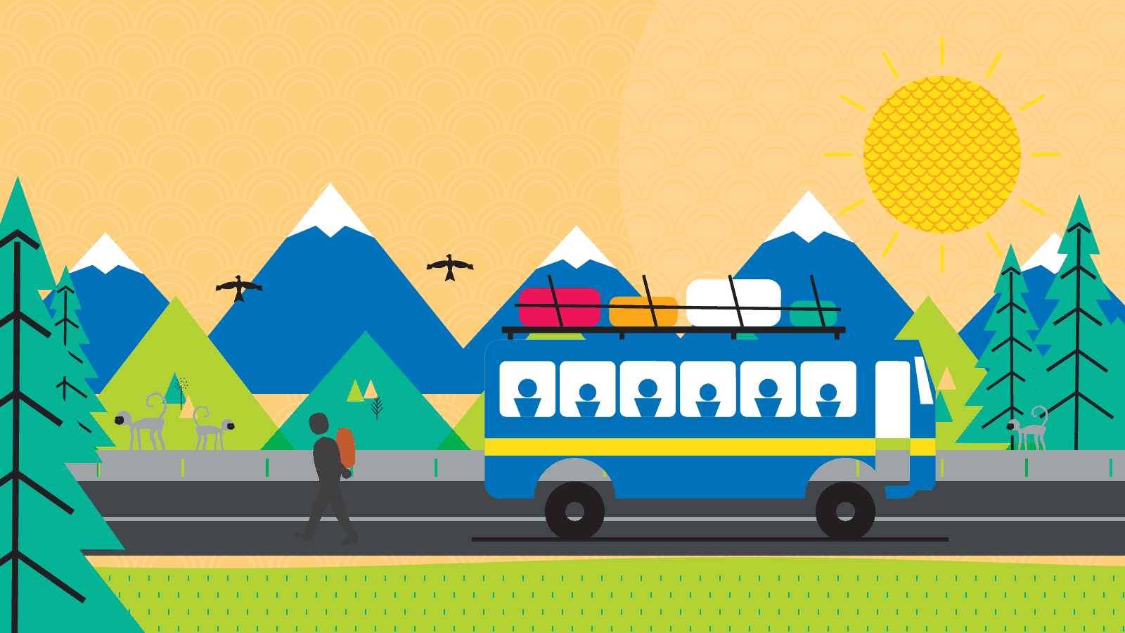
A golden winter afternoon at Banikhet: the hill bus up from Pathankot has pulled in at the stop with bags lashed on its roof, a traveller has stepped down and walks off along the road with his pack, a troop of grey langurs watches from the road's stone parapet, and black kites wheel over the valley under the snowy Dhauladhar.

Why this moment

Banikhet sits on the Pathankot–Dalhousie road about 6 km below Dalhousie in the Chamba hills; the hill bus, luggage on its roof rack, is still how most people arrive. Himalayan grey langurs are a common sight on the parapets and deodars along these roads, black kites ride the updrafts over the valley, and the clear winter air (October to February) brings the Dhauladhar's snow into view.

The sky wears Gond scales, from Madhya Pradesh.

The motion

Two black kites wheel over the valley; the sun's rays turn; the deodars sway; the langurs look round; the traveller walks. A 16-second loop.

Banikhet in symbols

Beside its icon, the things that are Banikhet, drawn in the Brand Manual's city language: a monument in the city grey with its openings cut, the things of the place in flat landscape colours. Each comes in colour and in the city grey. Every place's symbols

  • St John's Church, DalhousieMonument

    St John's Church, Dalhousie (1863), the oldest of the stone churches on Dalhousie's hills above Banikhet: locally quarried grey stone, a steep pitched roof, pointed Gothic Revival windows and a bell tower — drawn as plain architecture, the cross left off.

  • The hill busOf the place

    The hill bus up the Pathankot–Dalhousie road, Banikhet one of its stops: a single-deck bus with luggage lashed on its roof rack, the way most people still arrive.

  • Dainkund Peak, the open topOf the place

    Dainkund Peak above Banikhet, 'known locally as the Singing Hill' and 'the highest point in Dalhousie hill station', 'a popular sunrise spot' whose trail 'winds through deodar and pine forests, gradually opening into wide views of the snow-capped ranges' (Zostel's Khajjiar guide): the open, windy top. Banikhet's place icon is the hill and its singing deodars; this is the walk up the bald crest. The Air Force station and the summit temple are not drawn.

Also drawn for Banikhet 3

Detailed icons from the library that name Banikhet among their places: one drawing, on the page of every place it belongs to. Every detailed icon

Say hello to Banikhet's Zobus

Zobu in Banikhet's own dress, on the palette. Hover or tap one and it waves. Each comes still and alive — idle, hello and hop — for stickers, stories and the app.

Every destination's Zobus →

The animals of Banikhet

Animals and birds the research behind Banikhet's picture names, drawn in the Brand Manual's animal style, in colour and in the city grey. All the animals of India

The kit

Everything Banikhet needs: its profile, its cover, wide and tall, its icon, tile, display picture and lockup, its loop and the symbol becoming it, its second scene, its city map, its city symbols and its Zobus — every file ready to download.

50 files in one zip, the cover, its second scene, its symbols, its Zobus and its city map included
The Banikhet profile: its cover, its tile and its words
Profile

Banikhet’s page as a story, 1080 × 1920: its cover, its tile, its name, its line and its verbs — for stories, status and a phone’s lock screen.

The Banikhet cover, wide
Cover, wide

1600 × 900, for screens: a page’s top, a slide, a share card. The still is the loop’s first frame. The animated SVG loops in 16 s; where it shouldn’t move, use the still.

The Banikhet cover, tall
Cover, tall

900 × 1600, composed for a phone held upright: stories, reels, a lock screen. The animated SVG loops in 16 s; where it shouldn’t move, use the still.

Dainkund Peak — the Banikhet tile
Tile

The icon in one colour on Banikhet’s own — for a grid, a story, a sticker.

Dainkund Peak — the Banikhet icon
Icon

An object: flat landscape colours. Transparent; the mono takes any one colour.

Dainkund Peak, Banikhet — the icon, alive
Loop

Points twinkle behind the peak, or clouds drift past. 7.2 s, seamless.

Motion

The symbol becomes Banikhet and turns back — a Lottie loop for stories, the app and the web.

The Banikhet display picture, as a circleThe Banikhet display picture, square
Display picture

Circle-safe: the colour, the icon and the name — for chats, socials and the app.

Zostel Banikhet lockup
Lockup

The horizontal lockup, with Banikhet under the wordmark — for signage, email and merch.

St John's Church, DalhousieThe hill busDainkund Peak, the open top
City symbols

Banikhet’s symbols, each in colour and in the city grey, as SVG and PNG — in the zip’s symbols folder.

Banikhet Zobu, femaleBanikhet Zobu, male
Zobus

Banikhet’s Zobu pair, still and alive (idle, hello, hop), waving still and as a face (a profile picture) — in the zip’s zobus folder.

Also made for Banikhet 5

The rest of what the library holds for Banikhet: the pattern of its region, the card its links share, each opening its own file or gallery.

The map we made for Banikhet

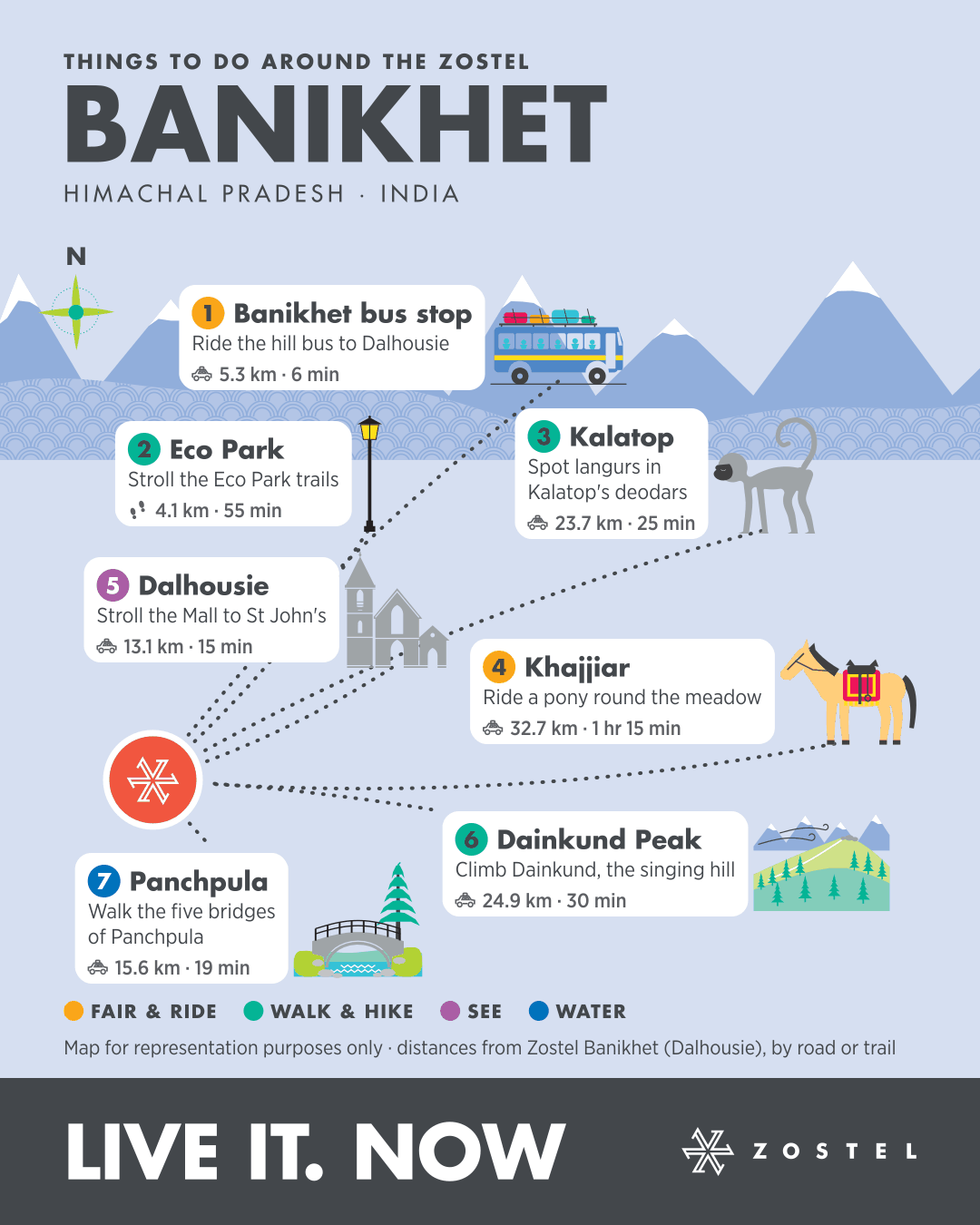
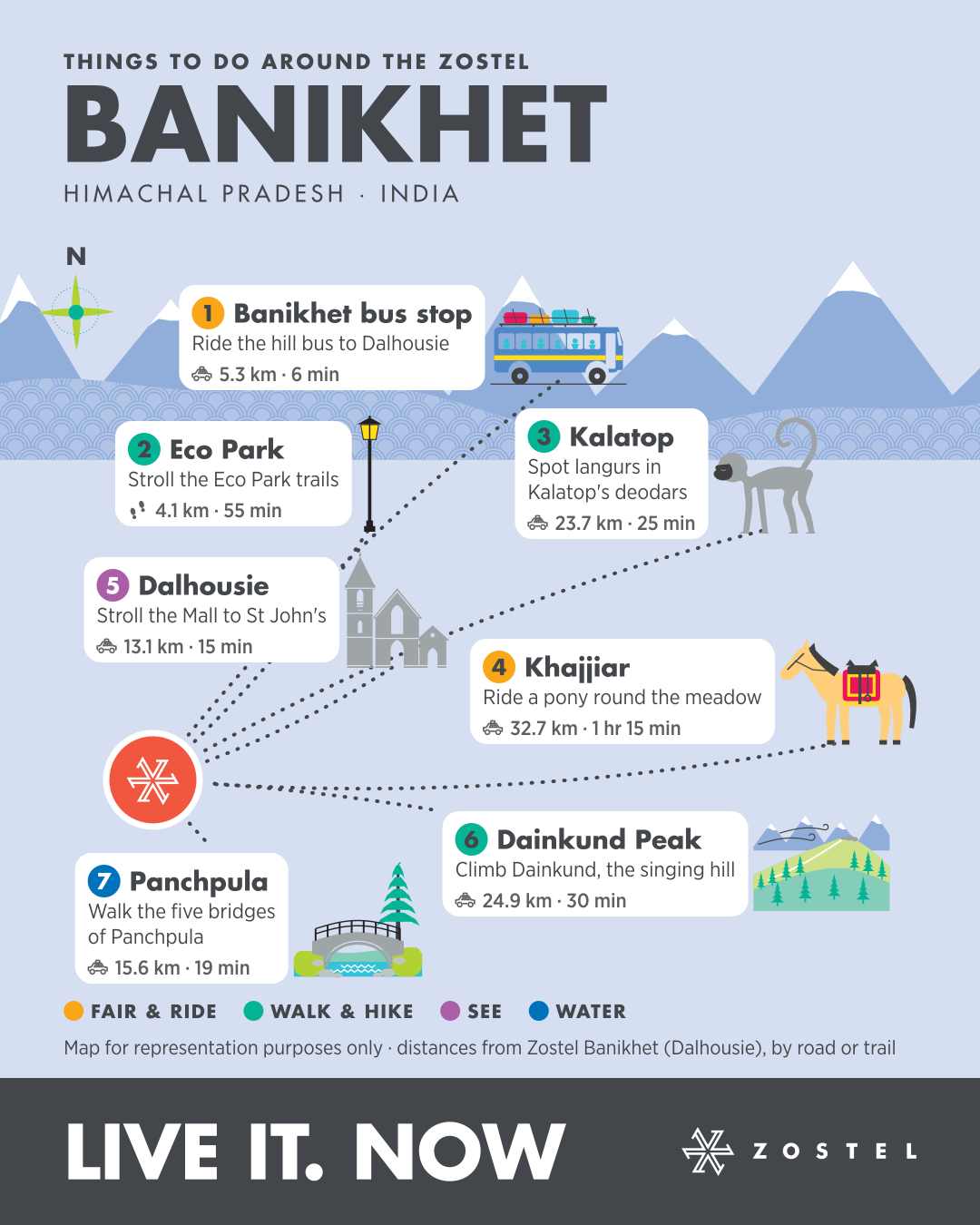
Seven things to do around Zostel Banikhet (Dalhousie), each in its true direction with its distance and time from the door — a map made for your phone.

  1. Ride the hill bus to DalhousieBanikhet bus stop · 5.3 km · 6 min drive
  2. Stroll the Eco Park trailsEco Park · 4.1 km · 55 min walk
  3. Spot langurs in Kalatop's deodarsKalatop · 23.7 km · 25 min drive
  4. Ride a pony round the meadowKhajjiar · 32.7 km · 75 min drive
  5. Stroll the Mall to St John'sDalhousie · 13.1 km · 15 min drive
  6. Climb Dainkund, the singing hillDainkund Peak · 24.9 km · 30 min drive
  7. Walk the five bridges of PanchpulaPanchpula · 15.6 km · 19 min drive

1080 × 1350, for a phone or a story. Distances and times from Zostel Banikhet (Dalhousie), measured on OpenStreetMap routing. Map for representation purposes only.

On the map

Banikhet is in Himachal Pradesh, India — one of the 84 places where Zostel is live.

Region
Himachal Pradesh
Country
India
Where
32.56° N, 75.98° E
Landscape
Valleys
Banikhet · Himachal Pradesh · India